Hey, folks. Anyone using Navionics FishNChip card in their GPS around the Charleston inland waterways? Does it supply good detail - we’re primarily fishing the Wando - but want better information when fishing new (to us) water as well. Does it include any navigation markers/data?
In a nutshell, is it worth $200 and a better bet than the Nav. Gold card?
I would say the FishNchip has little use in terms of actual navigation. It is not intended to be of navigational use, however.
Fishnchip shows nearshore and offshore bathy (bottom contours) and fishing data (some individual artificial reef structures).
I’ve used it in the lowrance pre-HDS units and the HDS, and the navionics gold or platinum contain great inshore nav data. You will get as much info as the latest paper charts basically.
Disclaimer: the smaller creeks and large shallow areas like Bulls Bay will not be that accurate on any card or charts, so don’t rely solely on them for navigation…
I fish offshore a bunch, so fishNchip is worth the $$ to me. If you never go offshore, I’d say it’s useless for you. It usually comes with Navionics’ better charts for free I thought though… ???
Thanks for the input. FNC used to come free w a gold or platinum card. Not any more. Sold solo. Anybody have the 2011 version? Perhaps since it’s a standalone it now has some of the nav info.
Thanks for the input. FNC used to come free w a gold or platinum card. Not any more. Sold solo. Anybody have the 2011 version? Perhaps since it’s a standalone it now has some of the nav info.
I have 2010 version on Lowrance HDS. FishNchip is on the same 16GB chart card that the navionics platinum is on. Can toggle the FishNchip on and off in the unit’s menus.
It appears no different than the 2005ish fishnchip that’s on a separate SD card for older units that I used to have. Only difference is the HDS will still show the Navionics platinum’s satellite overlay and points of interest on land, etc. while the fishNchip is cut on showing what it does where water is… Nav detail such as water depths and markers inshore and nearshore is greatly reduced when you have the fishNchip feature cut on.
It is not for navigation.
I can capture some screen shots of the harbor with and without the fishNchips cut on and post them here if you’d like to see what I mean.
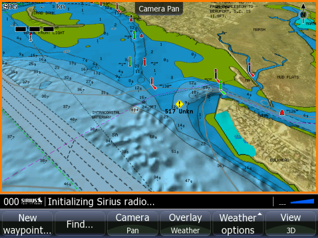
Normal navionics platinum with fishNchip cut OFF.
Crab bank is top left. Sullivans is bottom right.
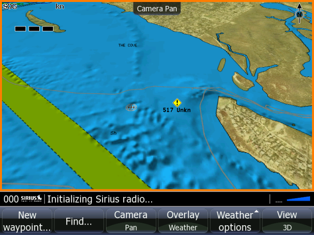
Cutting the fishNchip ON
Channel Markers and depths gone with fishNchip ON.
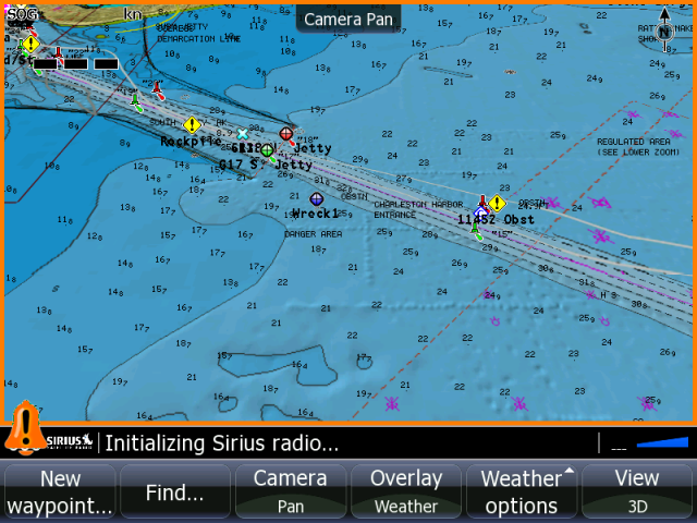
Jetty Entrance with fishNchip cut OFF.
Jetty Entrance with fishNchip cut ON. Only my waypoints for the jetty cans are still showing, and less depth detail.
Where the fishNchip gives you greater detail is deeper than about 60ft… The contours it shows are similar to what you see on a maps unique chart at that point. The artificial reefs are also marked on the fishNchip.
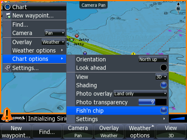
menu
menu
system
screen capture (enable it)
power button saves screen
repeat the above to disable that mode.
To get shots transfered onto a card go to pages, go to the files, waypoints, routes page.
Go into “my files”
then screenshots or either you will see the PNG format screenshots listed there by filenames.
highlight them by cursor and hit copy at the bottom of the screen. It will browse to your SD card then, and you select which card you want it saved to and hit enter. Do that with each shot you want copied to the card.
I usually take my chart card out while doing this or other waypoint transfers, etc. to avoid making a mistake with stuff going onto the chart card.
Waypoint transfer also happens much more quickly when I take the navionics platinum chip out during any such procedure. Transfers of large files take like 2 seconds instead of 15 seconds (estimating those times).
Great input. Thx for the screen shots. Looks nothing like what’s on their web site now …
No inshore nav data on the fishNchip chart. You will get reef structures marked that may be inshore/nearshore, but you don’t get nav markers.
The pics of the fishNchip on the navionics website are what it actually looks like offshore (white background w/ dark gray contour lines). Sorry I didn’t post a pic of that. Ran out of time to find a cool looking area where I didn’t have a lot of waypoints. Don’t want to post my waypoints on a public forum.
What you see in my screenshots is how I have my charting set up, and it’s definately a little different than what you see on the website. I have it in 3D mode, and I could have panned the camera angle downward so you could really see different elevations. Seeing the nav info is a little harder with it in that view, though. You can make it look at bit different with dif. overlay transparency and different deep water fill colors, etc. The units and charts have a pretty good level of customizable appearance/features.
Phin, those pics are really nice, and helpful. I have the FNC, and it’s ok for inshore fishing (actually too cluttered up with contour lines at times) in the areas I fish, but I recently had a chance to compare with the platinum chip my grandson bought, and the platinum is miles ahead for navigation. If I were to buy another, it would be the platinum, for sure.